These three photos are all from the Mossy Cave trail on the eastern edge of the park.
A view from Bryce Point looking out into the Amphitheater at sunset.
 A view to the west from Bryce Point after sunset. These rocks were mostly white with a little of the coral color.
A view from Sunrise Point at sunrise. Absolutely incredible colors!
A view of Queen's Garden from the trail at sunrise.
 There are several places where tunnels had to be dug in the rock for the trail. This section was still in the shadows after sunrise.
A view from the trail looking up at the rim at sunrise.
We named this rock formation ET!
A view from Fairyland Point - the formation in the upper center looks like a giant castle.
A mid-day photo of the Amphitheater from Bryce Point looking across at Sunset Point (center on the ridge) and Sunrise Point (right side on the ridge).
 An example of trees on the edge. The elements have exposed their roots and continually erode the edge, but the trees live on!
 Above and to the right are views from Rainbow Point - the highest part of the Park at over 9,000 feet elevation.
Coming down from Rainbow Point we stopped to let four deer cross the road.

Views from Fairyland Point. This canyon is smaller than the Amphitheater, but has many varied rock formations.
Red Canyon - West of Bryce on Highway 12 you encounter Red Canyon which has beautiful red vistas. In two places the highway runs through rock tunnels like the one shown below.
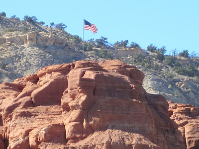
Here are a couple examples of the red rock in Red Canyon.
Costa Canyon - After exiting Red Canyon we took a dirt road to the north to explore Costa Canyon on an ATV.
Views of Costa Canyon from the ATV. It is a beautiful canyon and we climbed in elevation into a lot of pine trees.


